An Amazon rainforest map illustrates the immensity of the Amazon rainforest which extends 2.5 square miles (5.5 million square kilometers) across South America. Today, the Amazon represents over half (about 54%) of the planet’s remaining tropical rainforest regions and protects the largest reserves of natural resources in the world.
In South America, the Amazon covers parts of Brazil, Colombia, Peru, Venezuela, Ecuador, Bolivia and the Guianas: Guyana, French Guiana and Suriname.
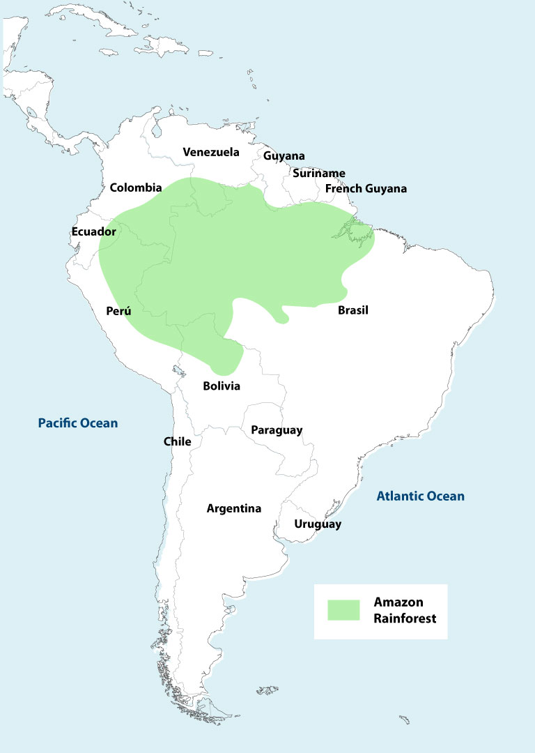
The main engine that powers and gives life to the rainforest is the Amazon River, which rises in the Andes of Peru and flows along more than 4,000 miles (6,440 kilometers) before emptying into the vicinity of Belem, Brazil. Along this journey, the Amazon River is fed by nearly 1,100 tributaries.
This map shows the current extent of the Amazon.
Scroll down to view the following maps:
Tropical Rainforest & Temperate Rainforest
There are two types of rainforest – tropical and temperate – that exist in the world.
Tropical Rainforest:
- The tropical rainforest region, also known as the tropic zone, resides near the equator.
- Temperatures close to the tropic zone are higher, causing accelerated evaporation of water, adding to the humidity levels. There is also frequent rain in forested areas in the tropics.
- The world’s tropical rainforests are in South and Central America, Africa, Australia, and cover only about 6% of the Earth’s surface.
- The largest tropical rainforest regions are in the Amazon River Basin, the Congo River Basin, and throughout much of Southeast Asia. There are many smaller ones located throughout the tropics including Central America, Madagascar, Australia, and India.
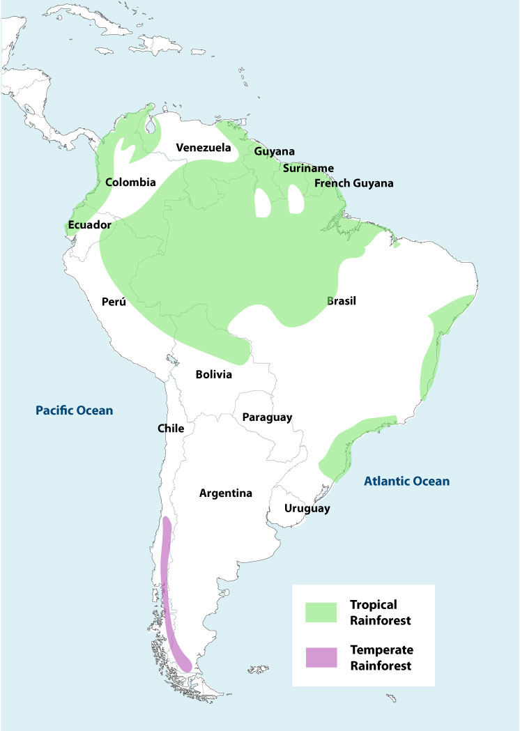
This map illustrates the two types of rainforest regions in South America.
Temperate Rainforest:
- Temperate rainforest is situated next to the coasts in the temperate zone. There are fewer temperate forests. Also, they cover a lot less area.
- Temperate rainforests reside in the temperate zones found in the Pacific Coast of the United States, Canada, and Chile. Other temperate rainforest can be found in New Zealand, Tasmania, Ireland, Scotland and Norway.
Map of the Amazon Jungle Borders
The yellow line of this map encloses the Amazon rainforest, while national borders are represented as black lines.
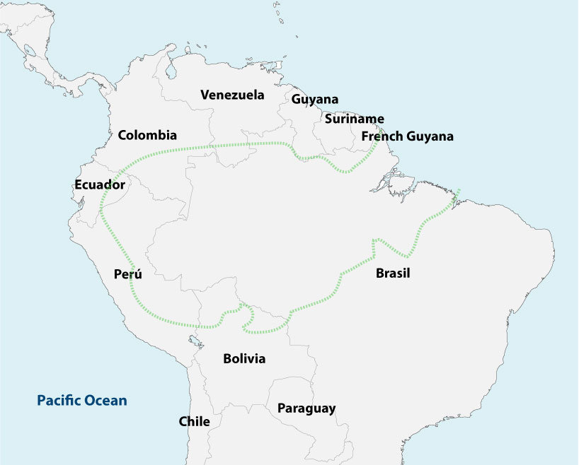
* The Venezuelan Amazon and the Guianas are not within the yellow line because these regions are not part of the Amazon River basin.
Peru Amazon Map
The Peruvian Amazon region covers an area of about 783,000 square kilometers within the Peruvian territory, at the east of the Andes Mountains in South America. About 60% of Peru’s national territory is covered by part of the most biologically diverse rainforests this planet has to offer. The only other country for which the Amazon rainforest covers a greater percentage of its territory it Brazil.
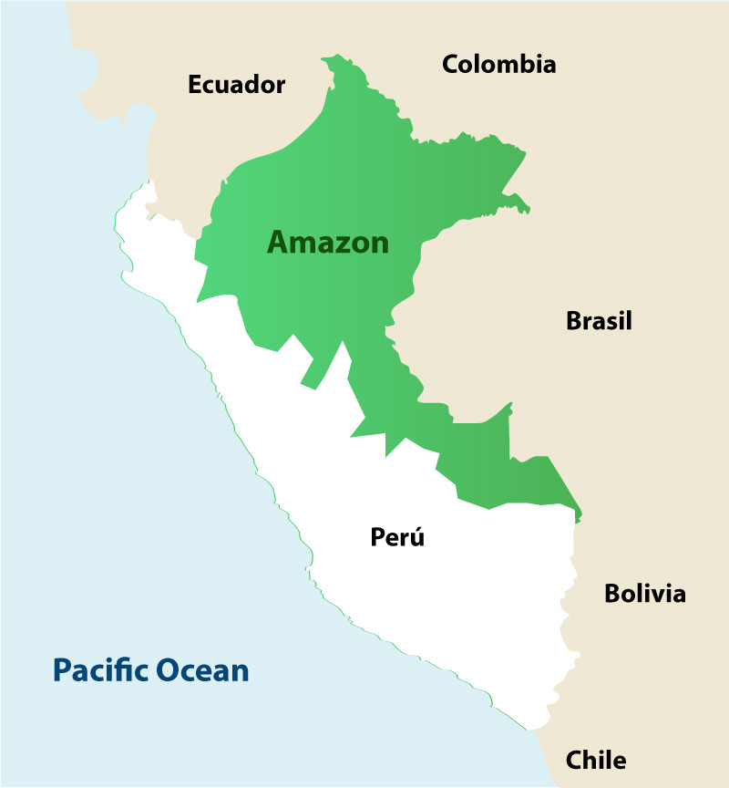
This Peru Amazon map shows the various jungle regions.
Read more about the different Amazon regions in Peru.
- Iquitos, Peru
- Manu National Park, Peru
- Puerto Maldonado, Peru